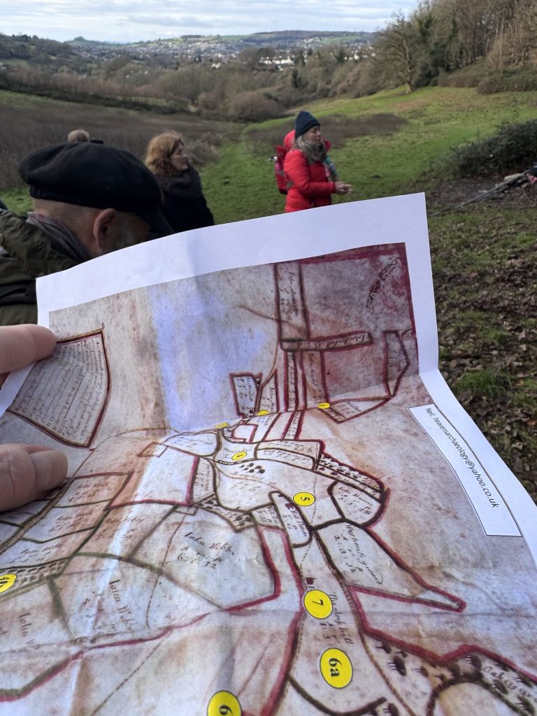
We went for 1/2 day walking workshop around the Heavens valley area of Stroud today. This tour was an archaeological trip around the area as a fundraiser for the community purchase of the land.
The map as spreadsheet
The starting point of the tour was a 1690’s map of the land and its subdivisions into rented areas. The map in the image above is the Clutterbuck family’s visual description of the space they owned.
The map is, as the archaeologist said, a spreadsheet. It’s a grid of values. The income demanded and expected from rental of different places with differing uses.
Maps aren’t simply descriptions of spaces. They are political and capitalist. They show boundaries and utilities. Lines and symbols of ownership, uncertainty and exploitation.
Maps in the UK are very political. The main provider of detailed information is the Ordnance Survey. It was established at the start of the 19th century to collect topographical data of Britain. This was essential military information. How could a country defend itself without knowing where exactly everything was and how it could be reached by the army?
This is the idea of maps as location data systems. The mathematical calculation and detailed symbology of spaces and places. There is no humanity in this mapping as it is about the needs of weapons to move across land.
This sense of map as tool is why the idea of the Clutterbuck map as spreadsheet is so meaningful. It shows what the landowner needed to know. It is not necessarily a map of all that is there.
Maps make choices about what is shown as defined by the needs of the people who authorise and pay for the creation.
Maps lose so much
There’s a 1950’s article about Not Getting Lost in which the author talks of how the indigenous people he was staying with in Greenland traced their route back in kayaks thru deep fog. He could detect nothing, he knew no way of wayfinding in this place.
The people described later how they traced a route by listening for the songs of snow buntings. The songs of each bird differed and they knew the song and place of each bird.
This is the micro-naming and knowledge of place that has been lost in most cultures.
Pre-literate and pre-map societies seem to have used what seems an almost mind boggling amount of place naming.
This over-naming came up in the walk today. A nearby hamlet’s name, in the early English terms, means something like the second farm building along. It is part of the micronaming of place that was lost when writing and maps came along.
Maps are crude. They cannot support the awesome level of naming that people used to share. The naming of trees, rocks and more. The placing of people in amongst the totality of living in the world.
Maps use visual design to clarify the relative position of places and use overlaid words and symbols to connect them and make routes explicit.
They lost the humanity of placemaking.
Wandering the hills of Stroud, we moved thru abandoned weaving workshops where Dutch immigrants made broad cloth. We ended the walk at the top of the Heavens where a Roman temple may lie. The view of the land from that spot was so magical and the water that sprang up there was so spiritual. The Romans saw that. They probably saw what earlier tribes saw. They connected place and people and perspectives.
Maps are valuable but do recognise what they are for and that their purpose means much has been lost.
One comment: